

 天天爆殺
天天爆殺  今日66折
今日66折 
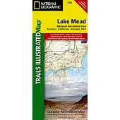
- Waterproof - Tear-Resistant - Topographic Map Straddling the border of Arizona and Nevada, Lake Mead National Recreati......more
![National Geographic Road Atlas 2022: Adventure Edition [United States, Canada, Mexico]](https://im1.book.com.tw/image/getImage?i=https://www.books.com.tw/img/F01/063/07/F010630774.jpg&v=5dc47db4k&w=170&h=170)
National Geographic’s Road Atlas: Adventure Edition, is the ideal companion for the next time you hit the road. Includes......more
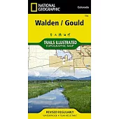
- Waterproof - Tear-Resistant - Topographic Map National Geographic’s Trails Illustrated map of Walden and Gould combine......more
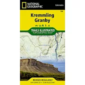
- Waterproof - Tear-Resistant - Topographic Map National Geographic’s Trails Illustrated map of Kremmling and Granby del......more
![Tahoe National Forest West [Yuba and American Rivers]](https://im2.book.com.tw/image/getImage?i=https://www.books.com.tw/img/F01/268/37/F012683779.jpg&v=5dc37158k&w=170&h=170)
- Waterproof - Tear-Resistant - Topographic Map Expertly researched and created in partnership with the U.S. Forest Serv......more
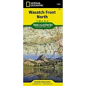
- Waterproof - Tear-Resistant - Topographic Map Year-round activities abound along Utah’s Wasatch Front region. National......more
- Waterproof - Tear-Resistant - Topographic Map At over 46,000 acres, Harriman State Park is the second largest state pa......more
- Waterproof - Tear-Resistant - Topographic Map The Weminuche Wilderness spans the Continental Divide and at nearly a ha......more
![Alpine Lakes Wilderness [Mt. Baker-Snoqualmie and Okanogan-Wenatchee National Forests]](https://im1.book.com.tw/image/getImage?i=https://www.books.com.tw/img/F01/269/46/F012694608.jpg&v=5dc3f632k&w=170&h=170)
- Waterproof - Tear-Resistant - Topographic Map Outdoor enthusiasts looking to explore of the Central Cascades will find......more
- Waterproof - Tear-Resistant - Topographic Map Enjoy the abundant recreational opportunities in northern Colorado with ......more
- Waterproof - Tear-Resistant - Topographic Map National Geographic’s Trails Illustrated map of Big South Fork National ......more
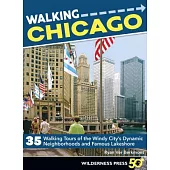
Featuring 35 self-guided walking tours, Walking Chicago leads readers through some of the city’s most interesting, sceni......more
- Waterproof - Tear-Resistant - Topographic Map Nestled in a high mountain valley surrounded by snowcapped peaks, former......more
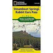
- Waterproof - Tear-Resistant - Topographic Map Known internationally as winter ski destination, Steamboat Springs is al......more
![Lexington, Blue Ridge MTS [George Washington and Jefferson National Forests]](https://im1.book.com.tw/image/getImage?i=https://www.books.com.tw/img/F01/268/35/F012683538.jpg&v=5dc32c50k&w=170&h=170)
- Waterproof - Tear-Resistant - Topographic Map Outdoor enthusiasts seeking to enjoy the endless recreational opportunit......more
![Salt River Canyon [Tonto National Forest]](https://im1.book.com.tw/image/getImage?i=https://www.books.com.tw/img/F01/268/37/F012683710.jpg&v=5dc3d872k&w=170&h=170)
- Waterproof - Tear-Resistant - Topographic Map Flowing across the southern part of Tonto National Forest, Salt River pr......more
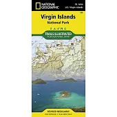
- Waterproof - Tear-Resistant - Topographic Map Virgin Islands National Park is an island paradise of white sand beaches......more
![Blacksburg, New River Valley [George Washington and Jefferson National Forests]](https://im1.book.com.tw/image/getImage?i=https://www.books.com.tw/img/F01/268/78/F012687840.jpg&v=5dc12f54k&w=170&h=170)
- Waterproof - Tear-Resistant - Topographic Map Outdoor enthusiasts seeking the bountiful recreational opportunities in ......more
- Waterproof - Tear-Resistant - Topographic Map Let National Geographic’s Trails Illustrated map of El Yunque National F......more
![Mazatzal and Pine Mountain Wilderness Areas [Coconino, Prescott, and Tonto National Forests]](https://im2.book.com.tw/image/getImage?i=https://www.books.com.tw/img/F01/268/81/F012688105.jpg&v=5dc3c44ak&w=170&h=170)
- Waterproof - Tear-Resistant - Topographic Map Outdoor enthusiasts looking for recreational opportunities just north of......more
![Fontana and Hiwassee Lakes [Nantahala National Forest]](https://im1.book.com.tw/image/getImage?i=https://www.books.com.tw/img/F01/268/91/F012689196.jpg&v=5dc2d883k&w=170&h=170)
- Waterproof - Tear-Resistant - Topographic Map Nestled in between the Cherokee and Chattahoochee National Forests, lies......more
![French Broad and Nolichucky Rivers [Cherokee and Pisgah National Forests]](https://im2.book.com.tw/image/getImage?i=https://www.books.com.tw/img/F01/268/91/F012689197.jpg&v=5dc336bck&w=170&h=170)
- Waterproof - Tear-Resistant - Topographic Map Outdoor enthusiasts seeking to explore the western parts of Cherokee and......more
![Goat Rocks, Norse Peak and William O. Douglas Wilderness Areas [Gifford Pinchot, Mt. Baker-Snoqualmie, and Okanogan-Wenatchee National Forests]](https://im1.book.com.tw/image/getImage?i=https://www.books.com.tw/img/F01/268/92/F012689288.jpg&v=5dc3f530k&w=170&h=170)
- Waterproof - Tear-Resistant - Topographic Map National Geographic’s Trails Illustrated map of Goat Rocks, Norse Peak, ......more
- Waterproof - Tear-Resistant - Topographic Map Outdoor enthusiasts seeking to explore the rugged topography of northwes......more
![Brasstown Bald, Chattooga River [Chattahoochee and Sumter National Forests]](https://im1.book.com.tw/image/getImage?i=https://www.books.com.tw/img/F01/269/46/F012694678.jpg&v=5dc3b839k&w=170&h=170)
- Waterproof - Tear-Resistant - Topographic Map An abundance of recreational opportunities abound in the Chattahoochee a......more
![Crystal Basin, Silver Fork [Eldorado National Forest]](https://im2.book.com.tw/image/getImage?i=https://www.books.com.tw/img/F01/269/48/F012694899.jpg&v=5dc27959k&w=170&h=170)
- Waterproof - Tear-Resistant - Topographic Map National Geographic’s Trails Illustrated map of Crystal Basin and Silver......more
![Green Mountain National Forest [Map Pack Bundle]](https://im1.book.com.tw/image/getImage?i=https://www.books.com.tw/img/F01/349/10/F013491070.jpg&v=5dc215e9k&w=170&h=170)
- Waterproof - Tear-Resistant - Topographic Maps The Green Mountain National Forest Map Pack Bundle is the perfect compa......more

...more
- Waterproof - Tear-Resistant - Topographic Map Expertly researched and created in partnership with local land managemen......more
...more
...more
Description The durable and convenient Ohio EasyToFold state map will take all the wear and tear your journey can dish o......more
- Waterproof - Tear-Resistant - Topographic Map Colorado’s Roaring Fork Valley is a popular destination for year-round o......more
- Waterproof - Tear-Resistant - Topographic Map Expertly researched and created in partnership with local land managemen......more
- Waterproof - Tear-Resistant - Topographic Map National Geographic’s Trails Illustrated map of Red Feather Lakes and Gl......more
- Waterproof - Tear-Resistant - Topographic Map National Geographic’s Trails Illustrated map of Green Mountain Reservoir......more
Rand McNally s folded map for Detroit is a must-have for anyone traveling in and around the Detroit area and Southeaster......more
- Waterproof - Tear-Resistant - Topographic Map National Geographic’s Trails Illustrated map of Breckenridge and Tenness......more
Description Rand McNally s folded map for Las Vegas/The Strip is a must-have for anyone traveling in and around this par......more
- Waterproof - Tear-Resistant - Topographic Map National Geographic’s Trails Illustrated map of Deckers and Rampart Rang......more
...more
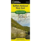
- Waterproof - Tear-Resistant - Topographic Map The first National River to be designated in the United States, the Buff......more
- Waterproof - Tear-Resistant - Topographic Map National Geographic’s Trails Illustrated map of Kebler Pass and Paonia R......more
- Waterproof - Tear-Resistant - Topographic Map Outdoor enthusiasts looking to enjoy the pristine areas in southern Roos......more
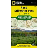
- Waterproof - Tear-Resistant - Topographic Map National Geographic’s Trails Illustrated map of Rand and Stillwater Pass......more
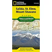
- Waterproof - Tear-Resistant - Topographic Map National Geographic’s Trail Illustrated map of Salida, St. Elmo and Moun......more
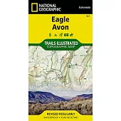
- Waterproof - Tear-Resistant - Topographic Map National Geographic’s Trails Illustrated map of Eagle and Avon is the ul......more
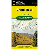
- Waterproof - Tear-Resistant - Topographic Map At an elevation of over 11,000 feet, the Grand Mesa is one of the larges......more
![Uncompahgre Plateau South [Uncompahgre National Forest]](https://im1.book.com.tw/image/getImage?i=https://www.books.com.tw/img/F01/269/04/F012690472.jpg&v=5dc48a55k&w=170&h=170)
- Waterproof - Tear-Resistant - Topographic Map National Geographic’s Trails Illustrated map of Uncompahgre Plateau Sout......more
- Waterproof - Tear-Resistant - Topographic Map Outdoor enthusiasts seeking to explore the remote and untamed mountains ......more
- Waterproof - Tear-Resistant - Topographic Map Flowing freely for 153 miles in northern Arkansas, the wild and fully pr......more
...more
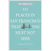
Part of the international 111 Places/111 Shops series with over 150 titles and 1 million copies in print worldwideAppeal......more

Everyone Loves New York is a delightful homage to the City that Never Sleeps-- a perfect book for all "New Yorkers," rea......more
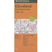
Rand McNally s folded map for Cleveland is a must-have for anyone traveling in and around this part of Ohio, offering un......more
In places like the valley town of Alma, once known to Butch Cassidy and the Wild Bunch, and through the dusty streets of......more
One of the most famous scenic places on earth, the Yosemite Region is highlighted by Yosemite National Park s famous gra......more

A lush and mountainous gem in the Pacific Northwest, Oregon is a great place to observe and learn about birds, owing to ......more
...more

...more
Olympic National Park’s towering mountains, old-growth forests and rugged coastline provide a variety of habitats for th......more
...more
...more
...more
...more
...more
Rand McNally s folded map for Buffalo and Niagara Falls is a must-have for anyone traveling in and around this part of N......more
...more
...more
Michelin regional maps each contain practical road and route information. Special Michelin reads-like-a-book format for ......more
Rand McNally s folded map for Central & Eastern Florida is a must-have for anyone traveling in and around this area, off......more
...more
From Amelia Island to the Keys to Pensacola in the Panhandle, the coast of Florida is dotted with lighthouses of all siz......more
Description The durable, convenient Rand McNally Indiana EasyFinder maps take all the wear and tear your journey can dis......more
The number of microbreweries in New England has grown by leaps and bounds since the first edition of this guide was publ......more
Basic Tracking is the essential guide to take on your next wilderness adventure. Having knowledge of the surrounding ter......more
...more
...more
Be it a weekend holiday, a staycation, or a tour of the coast, this companion guidebook offers an insider s pick of th......more

Buzzed boldly goes where no New England craft beverage book has gone before, tapping New England s burgeoning craft beer......more
This authoritative guide to the waterways of Wisconsin presents many of the state’s paddleable waterways in 60 paddling ......more

The long-nosed American snout is one of over 1,000 species of butterflies and moths found in the diverse ecosystems of......more
...more

Best Bike Rides Connecticut describes 40 of the greatest recreational rides in the Connectiut. Road rides, rail rides, b......more
...more
Fully updated in 2016...Marco Polo maps feature completely up-to-date, digitally generated mapping. The high quality car......more
...more
This guide to 60 of the best hikes around south-central Pennsylvania leads you to beautiful scenery and historic sites....more
博客來數位科技股份有限公司 統編 : 96922355 地址:臺灣 115 台北市南港區八德路四段768巷1弄18號B1之1 食品業者登錄字號:A-196922355-00000-9
Copyright © since 1995 books.com.tw All Rights Reserved.
 博客來
博客來 博客來
博客來 博客來
博客來 博客來
博客來 博客來
博客來