
The book "The Rise of the Digital Nomad and the Age of the Telecommuter" is a smart look at how people work today, based......more
Machine learning (ML) refers to an artificial intelligence (AI) technique that teaches computers to learn from experienc......more
Remote sensing is the science of obtaining information about objects or areas from a distance, usually from satellites a......more
Earth sciences refers to the branch of science that deals with the physical, chemical and biological complex constitutio......more
The variability and variety of plant life which exists on the Earth is known as plant biodiversity. It faces threats fro......more
The variability and variety of plant life which exists on the Earth is known as plant biodiversity. It faces threats fro......more
Earth observation refers to the gathering of information about the physical, chemical and biological systems of the plan......more
A geographic information system (GIS) refers to a type of computer based information system that displays and analyzes g......more
Satellite radar altimetry refers to a technique that is used for calculating the vertical distance between a satellite a......more
A sensor is a device that detects and responds to some type of input from the physical environment such as light, heat, ......more
Remote sensing refers to a process involving the identification and observation of the topographies of a region by measu......more

...more
Re-envisioning Remote Sensing Applications: Perspectives from Developing Countries aims at discussing varied application......more

...more

...more

...more

A comprehensive, introductory text on how to use unmanned aircraft systems for data capture and analysis. It provides be......more

...more

Remote Sensing Applications in Environmental and Earth System Sciences is a contemporary, multi-disciplinary, multi-scal......more
Revised and streamlined for learning the latest ArcGIS(R) Pro tools and workflows, GIS Tutorial for ArcGIS Pro 3.1 is th......more
A satellite altimeter calculates the time taken by a short electromagnetic pulse for completing a round trip. This elect......more
Sensors are small devices that are used to measure or detect natural Earth conditions such as motion, heat, or light, an......more
Disasters refer to severe disruptions that affect the functioning of a community, to an extent which is beyond its copin......more
Renewable energy is the type of energy that is derived from renewable sources of energy. Hydro energy, geothermal energy......more
Digital Earth is a virtual representation of the Earth that allows users to explore and engage with massive amounts of h......more
Digital Earth is a virtual representation of the Earth that allows users to explore and engage with massive amounts of h......more
Digital Earth is a virtual representation of the Earth that allows users to explore and engage with massive amounts of h......more
Digital Earth is a virtual representation of the Earth that allows users to explore and engage with massive amounts of h......more
Geoinformation technology refers to a science that deals with the acquisition, storage, management, analysis and deliver......more
The process of gathering information about the physical, chemical and biological systems of the Earth is called Earth ob......more
Remote sensing is a type of geospatial technology that is used to acquire information about an object or phenomenon with......more
Remote sensing technology encompasses the systems that use digital cameras and remote control systems for obtaining phot......more

This text explores the spatial variation and seasonality in growth and reproduction of "Enhalus acoroides" Royle populat......more
Discover The Geographic Approach to help restore, preserve, and protect the environment. As we continue to uncover and l......more
The second volume of this comprehensive global perspective on Integrated Drought Management is focused on drought modeli......more

The first volume of this comprehensive global perspective on Integrated Drought Management is focused on understanding d......more

Starting with basic airmanship and progressing to drone employment in the field and equipment the drone operator should ......more
Get up to speed quickly on the core topics and career paths that open source GIS has to offer. What is Open Source GIS? ......more
Soil and crop sensing is a fundamental component and the first important step in precision agriculture. Unless the level......more
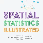
With approachable explanations and uncomplicated drawings, Spatial Statistics Illustrated gives readers an accessible un......more

Top 20 Essential Skills for ArcGIS(R) Pro introduces the most important skills so you can get up and running with geogra......more
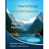
The objective of this book is to provide you the reader a complete systems engineering treatment of GNSS. We are experts......more
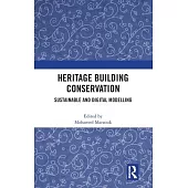
This book provides a holistic perspective on the sustainable conservation of heritage buildings through outlining the fa......more
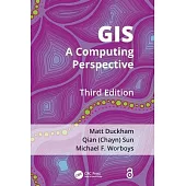
Following two successful editions, the third edition of GIS has been revised and updated, with extensive new content ref......more
This textbook integrates GIS, spatial analysis, and computational methods for solving real-world problems in various pol......more

This set includes the third edition of Computational Methods and GIS in Social Science and the accompanying lab manual. ......more
Normal 0 false false false EN-GB X-NONE X-NONE...more

India is one of the most religiously and ethnically diverse nations in the world with some of the most deeply religious ......more
Geographic Information Systems or popularly known as GIS has been developing it’s roots since the role of remote sensing......more
The contents of the book are of a high quality and flow very smoothly from the characterization of biophysical resources......more
Arid and semi-arid areas are now facing a threefold holistic crisis: economic, food, and climate. What has emerged from ......more
Geomorphology is the study of external landscape/architecture of earth’s crust which stands as a testimony not only for ......more
Based on the success of the previous four editions, this new fifth edition includes Global Navigation Satellite Systems ......more
The use of small unoccupied aerial systems (sUAS) for acquiring close-range remotely sensed data has substantially incre......more

The book entitled, "Improving Productivity of Drylands by Sustainable Resource Utilization and Management" deals with a ......more

Hyperspectral imaging is an emerging modern technique in modern remote sensing that expands and removes capability of mu......more
This new textbook on remote sensing and digital image processing of natural resources includes numerous, practical probl......more
This Lab Manual is a companion to the textbook Remote Sensing and Digital Image Processing with R. It covers examples of......more
...more

This book guides readers through the most iconic geologically significant scenery in the UK, points out features of inte......more

This book guides readers through the most iconic geologically significant scenery in the UK, points out features of inte......more
Monitoring continuous phenomena by stationary and mobile sensors has become a common due to the improvement in hardware ......more
Satellite Interferometry Data Interpretation and Exploitation: Case Studies from the European Ground Motion Service (EGM......more
This book examines the remote sensing technology used to gather information on 12 types of natural hazards in the terres......more
Precise and accurate localization is one of the fundamental scientific and engineering technologies needed for the appli......more

This book fills the need of upcoming changes in geo-informatics and basic level up-gradation and comprehensive text on d......more
This open access volume contains the proceedings of the 5th Symposium on Terrestrial Gravimetry: Static and Mobile Measu......more
This open access volume contains the proceedings of the 5th Symposium on Terrestrial Gravimetry: Static and Mobile Measu......more

...more

"It’s the big intention, portray the evolution of the world of Civil Engineering, what happened in recent decades, but w......more
Since the publication of the bestselling second edition 5 years ago, vast and new globally-relevant geographic datasets ......more
Spatial Thinking in Environmental Contexts: Maps, Archives, and Timelines cultivates the spatial thinking "habit of mind......more

Radar polarimetry has been highly sought after for its use in the precise monitoring of Earth’s surface. Polarimetric SA......more
With urbanization as a global phenomenon, there is a need for data and information about these terrains. Urban remote se......more
Radar scattering and imaging of rough surfaces is an active interdisciplinary area of research with many practical appli......more

Gender inequality is entrenched in the cultural, political and market systems that operate at household, community, and ......more
This book contains papers presented at the International Workshop on Tropical Wetlands, held in Banjarmasin, Indonesia. ......more

Control systems are pervasive in our lives. Our homes have environmental controls. The appliances we use at home, such a......more
The second edition of this introductory GIS textbook is thoroughly rewritten and updated to respond to the demand for cr......more
...more
Geospatial data acquisition and analysis techniques have experienced tremendous growth in the last few years, providing ......more
On-board image processing systems are used to maximize image data transmission efficiency for large volumes of data gath......more

With speeds of up to 20 gigabits per second and the ability to support up to one million devices per square kilometer, 5......more
...more
Geographic Information System (GIS) is one of the most important tools to help us understand public health and many aspe......more

The book "Remote sensing big data framework" by K.R. Sivabalan explores the use of remote sensing and big data technique......more
A comprehensive resource on airborne synthetic aperture radar (SAR) systems, Airborne Circularly Polarized SAR explains ......more
Modern tree fruit orchards and vineyards constitute complex production systems that are exposed to highly dynamic and st......more
The number of Earth observation satellites launched in recent years is growing exponentially, along with the datasets th......more
The number of Earth observation satellites launched in recent years is growing exponentially, along with the datasets th......more
Discover The Geographic Approach to managing natural resources for efficiency and sustainability. Managing Our World: GI......more
This book elaborates fuzzy machine and deep learning models for single class mapping from multi-sensor, multi-temporal r......more
Understanding GIS through Sustainable Development Goals applies a pedagogical shift to learning GIS, as the readers empl......more
...more
...more

Monitoring drought’s slow evolution and identifying the end of a drought is still a big challenge for scientists, natura......more
A comprehensive consolidation of data for the world, this book gives a short precis of each nation, each nation’s histor......more