

 天天爆殺
天天爆殺  今日66折
今日66折 


- Waterproof - Tear-Resistant - Topographic Map
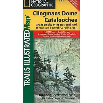
America’s most visited national park and a UNESCO World Heritage Site, Great Smoky Mountains National Park is both renowned for its diversity of plant and animal life and rich in remnants of Southern Appalachian mountain culture. National Geographic’s Trails Illustrated map of Clingmans Dome and Cataloochee, covers the eastern part of the park, from Sugarlands Visitor Center to the eastern boundary of the park with Pisgah National Forest. Created in partnership with the National Park Service and others, the map combines unparalleled detail and valuable information for outdoor enthusiasts seeking to explore all the area has to offer with particular attention shown to backcountry campsites, shelters, and stream crossings. The map features many key points of interest as well, including Mount Le Conte, Balsam Mountain, Roaring Fork and Newfound Gap.
The park map has clearly marked trails with mileages between intersections. The map base includes contour lines and elevations for summits, passes and many lakes. The map also includes lists of backcountry campsites and shelters along with their location, elevation and capacity. A detailed profile of the Appalachian National Scenic Trail, which snakes along the ridge of the Great Smoky Mountains, provides a handy tool for hikers. Some of the many recreation features include: visitor centers, campgrounds, trail shelters, trailheads, boat ramps, scenic overlooks, waterfalls, lookout towers, interpretive trails and quiet walkways.
Every Trails Illustrated map is printed on "Backcountry Tough" waterproof, tear-resistant paper. A full UTM grid is printed on the map to aid with GPS navigation.
Other features found on this map include: Clingmans Dome, Great Smoky Mountains, Mount Chapman, Mount Le Conte, Newfound Gap, Old Black, Pisgah National Forest.
- Map Scale = 1:40,000
- Sheet Size = 25.5" x 37.75"
- Folded Size = 4" x 7.5"


 博客來
博客來 博客來
博客來 博客來
博客來 博客來
博客來 博客來
博客來