

 天天爆殺
天天爆殺  今日66折
今日66折 

This book provides a comprehensive reference for solving scientific problems with the generalized linear geostatistical ......more
This lab manual is a companion to the third edition of the textbook Computational Methods and GIS Applications in Social......more

Security First: Geospatial Workflows for a Safe and Equitable World shows how GIS can be used to address some of the mos......more

Getting to Know Mobile GIS empowers readers to creatively use mobile GIS and drive innovation in this fast-advancing fie......more
Handbook of Satellite Land Products compiles the key information of as many satellite products as possible for each esse......more
Leading with Data: A Police Commander’s Guide to GIS & Crime Analysis is the essential text for commanders to use spatia......more
Unique and authoritative reference combining concepts, theories, and hands-on analysis in the ArcGIS Pro software enviro......more
Top 20 Essential Skills for Python in ArcGIS(R) guides you through the basics of Python and developing solutions to enha......more
Comprehensive resource reviewing the state of the art in wireless identification and sensing systems, proposing several ......more
...more

Discover a geographic approach to defense and intelligence. Mission-Critical Mapping: GIS for Defense and Intelligence e......more
Learn from the best with this popular book on creating successful maps with any GIS or illustration product, written by ......more
Timely and reliable information on natural resources, regarding their potential and limitations, is a prerequisite for s......more
From Prague to Berkeley to Nairobi to Kyiv, The Geography of Hope tells the stories of optimists who map the world and m......more
The third edition of the bestselling Classification Methods for Remotely Sensed Data covers current state-of-the-art mac......more
...more
Embark on an extraordinary journey into the depths of the ocean. Oceanographer Dawn Wright made history in 2022 when she......more
Tackle complex spatial data tasks effortlessly with this easy-to-follow guide to writing specialized Python scripts and ......more
Unlock the power of Python in ArcGIS(R) Pro with this definitive, easy-to-follow guide designed for users with limited p......more
Applications of Geospatial Technology and Modeling for River Basin Management covers the use of multi-temporal satellite......more
This new edition introduces the fundamentals of passive microwave remote sensing of oceans including the physical princi......more
GNSS Monitoring of the Terrestrial Environment: Earthquakes, Volcanoes, and Climate Change presents the application of G......more
Remote Sensing of Climate provides cutting-edge techniques in remote sensing of climate variability and the environment.......more
Remote Sensing and GIS in Peri-Urban Research: Perspectives on Global Change, Sustainability and Resilience, Eleventh Ed......more
Over the past decade, since the publication of the first edition, there have been new advances in solving complex geoinf......more
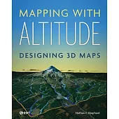
Add an extra dimension to your maps. You live in a 3D world--your maps need to be 3D, too. Representing and reviewing da......more
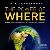
The Power of Where presents the visionary concepts of Jack Dangermond, cofounder of Esri(R), the world’s leading mapping......more
...more
Location Awareness in the Age of Google Maps explores the mundane act of navigating cities in the age of digital mapping......more
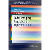
Polarimetric rotation domain interpretation is an innovation in radar image processing and understanding. Orientation ro......more
Geology and Natural Resources of Nigeria is an up-to-date and comprehensive overview of the geological framework of the ......more
Light detection and ranging, or LiDAR, is an advanced active remote sensing technology developed in the last 30 years to......more
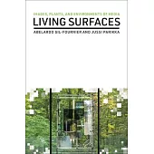
"The book explores how scrutinizing images can help understand Earth’s surfaces through a series of case studies that sp......more
Making interactive web maps has never been easier. Top 20 Essential Skills for ArcGIS Online guides readers, step by ste......more
Advances in signal and image processing for remote sensing have been tremendous in recent years. The progress has been p......more
Lunar explorations have received increasing attention in recent years with tremendous application values, including usin......more
Geographical Information Science: Case Studies in Earth and Environmental Monitoring provides detailed remote sensing an......more
This book is the second in a two-volume series that introduces the field of spatial data science. It moves beyond pure d......more
Learn to use ArcGIS Pro confidently, quickly, and effectively with the newest edition in this best-selling series. Getti......more
Surveying with Geomatics and R This book explains basic concepts of surveying science and techniques with geomatics usin......more
The wide range of challenges in studying Earth system dynamics due to uncertainties in climate change and complex interf......more
This textbook provides comprehensive and in-depth explanations of all topics related to spatial analysis and spatiotempo......more
Hospital service areas (HSAs) and hospital referral regions (HRRs) are considered more appropriate units than geopolitic......more
This book offers a unique multidisciplinary integration of the physics of turbulence and remote sensing technology. Remo......more
Spatial predictive modeling (SPM) is an emerging discipline in applied sciences, playing a key role in the generation of......more
Co-location pattern mining detects sets of features frequently located in close proximity to each other. This book focus......more
...more
"The Open Access version of this book, available at https: //www.taylorfrancis.com/books/oa-edit/10.1201/9781003181590, ......more
While technology is developing at a fast pace, urban planners and cities are still behind in finding effective ways to u......more
The mushrooming of illegal housing on the periphery of cities is one of the main consequences of rapid urbanisation asso......more
This book clarifies the smart city concept that is gaining application in Sub - Saharan Africa. It shows how the smart c......more
Remote Sensing and Image Processing in Mineralogy reveals the critical tools required to comprehend the latest technolog......more
This book is aimed at the level of beginners, with no prior experience of GIS or QGIS required. This text takes the read......more

This book teaches the basic stages of mapping for ecological projects. It uses QGIS, an open source system, as this is t......more
Oil palm cultivation is a significant contributor to the global agricultural industry, providing valuable resources for ......more
This book provides theoretical and practical insights into city modelling from a geomatics perspective. It offers a crit......more
This book is for students and professionals involved in Geospatial Computations and related areas such as Geomatics, Sur......more
The fourth edition of a well-established book in cartography explores the continued evolution of the Internet and Web 2.......more
This comprehensive handbook presents the current state of knowledge on geospatial technologies, techniques, and methods ......more
Heavy Metal: Earth’s Minerals and the Future of Sustainable Societies brings together world-leading experts from across ......more
Heavy Metal: Earth’s Minerals and the Future of Sustainable Societies brings together world-leading experts from across ......more
Polar Ice and Global Warming in Cryosphere Regions is based on recent and past climate variabilities data gathered throu......more
Landscape Evolution of Continental-Scale River Systems: A Case Study of North America’s Pre-Pleistocene Bell River Basin......more
Fieldwork Handbook gives you tips, best practices and activities for using location intelligence in the field to make yo......more
Discover a geographic approach to resilience strategies for wildland fire. Wildfires claim lives, destroy structures, an......more
Ionospheric Effects on Global Navigation Satellite Systems: Modelling and Prediction of Ionospheric Delays is a comprehe......more

...more
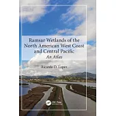
This is the first comprehensive international atlas featuring all ecological services provided by Ramsar wetlands, with ......more
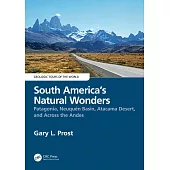
This book takes readers through the most iconic geologically significant scenery in South America, points out features o......more
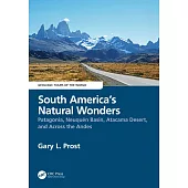
This book takes readers through the most iconic geologically significant scenery in South America, points out features o......more
Provides students and practitioners an understanding of theory and application of lake ice processes Includes exercises ......more
This work is a collective achievement of renowned scientists working in South and Southeast Asia. They discuss the compl......more
This book offers an interdisciplinary perspective on the impacts of biomass burning on environmental resources, climate,......more
In Mapping Your Mission: GIS for Nonprofits, readers will learn how nonprofits advance their mission through engaging st......more
GIS and Housing: Principles and Practices discusses how GIS can enhance our understanding of complex housing issues in t......more
This comprehensive handbook covers Geospatial Artificial Intelligence (GeoAI), which is the integration of geospatial st......more
Responsible land distribution in Asia, with ever-increasing limitations in space, requires the use of smart technologies......more
The compendium summarizes the seismic exploration history, geophysical exploration technology progress, application and ......more
Teaching Mathematics Using Interactive Mapping offers novel ways to learn basic math topics such as simple relational me......more
Spatial SQL: A Practical Approach to Modern GIS Using SQL by Matthew Forrest Learn to create, index and query spatial da......more

Teaching Mathematics Using Interactive Mapping offers novel ways to learn basic math topics such as simple relational me......more
Harness the powerful Python programming language to navigate the realms of geographic information systems, remote sensin......more
Multiscale Geographically Weighted Regression (MGWR) is an important method for exploring spatial heterogeneity and mode......more
Overview of Geographic Information Systems (GIS)In today’s rapidly advancing world, Geographic Information Systems (GIS)......more
Discover The Geographic Approach to enabling science for a more exceptional planet. Place matters to governments and cit......more
This book aims at integrating archaeology with science in order to provide additional information with respect to a trad......more
Earth Observation in Urban Monitoring: Techniques and Challenges presents the latest techniques of remote sensing in urb......more
Studies on South Asia are an emerging interdisciplinary field, this volume expands on the currently limited literature a......more
This book gives readers detailed explanations of the techniques used to map and monitor the built and natural environmen......more
This collection of stories by HENRY MANN seeks to put many of his fiction ideas into a single draft and provide them at ......more
A Short Introduction to Geospatial Intelligence explains the newest form of intelligence used by governments, commercial......more
A Short Introduction to Geospatial Intelligence explains the newest form of intelligence used by governments, commercial......more
This lab manual is a companion to the third edition of the textbook Computational Methods and GIS Applications in Social......more
Civil Engineering and Disaster Prevention focuses on the research of civil engineering, architecture and disaster preven......more
Spatial information technology and its integration, such as remote sensing, geographic information systems (GIS), and gl......more
博客來數位科技股份有限公司 統編 : 96922355 地址:臺灣 115 台北市南港區八德路四段768巷1弄18號B1之1 食品業者登錄字號:A-196922355-00000-9
Copyright © since 1995 books.com.tw All Rights Reserved.
 博客來
博客來 博客來
博客來 博客來
博客來 博客來
博客來 博客來
博客來